Yang Chen's Homepage
  • Bio
  • Papers
  • News
  • Experience
  • Projects
ESC

Searching...

No results found

↑↓ Navigate ↵ Select
Powered by Hugo Blox
  • Recent & Upcoming Talks
    • Example Talk
  • Projects
    • Vision2Slope: estimating urban road slopes with street view imagery
    • Deep-Time Digital Earth Geomorphology Project
    • Marine polymetallic mineral systems
  • Publications
    • Vision2Slope: estimating urban road slopes with street view imagery
    • Revealing the co-occurrence patterns of public emotions from social media data
    • A graph neural network for small-area estimation: integrating spatial regularisation, heterogeneous spatial units, and Bayesian inference
    • Vertical 15-minute city: Modeling urban density and functional mix with multi-source geospatial data
    • A typology of global relief classes derived from digital elevation models at 1 arcsec resolution
    • Understanding the hydrological valley landscape: A multi-scenario adaptive framework for delineating valley floors
    • Characterizing spatial patterns and regionalization of anthropogenic landforms using multi-source geospatial data: Insights from Loess Plateau of China
    • Deep learning detects entire multiple-size lunar craters driven by elevation data and topographic knowledge
    • Delineating individual alluvial fans and morphological analysis based on digital elevation models
    • Assessing the influence of geo-environmental factors on discontinuous gully erosion at regional scales: A case study of spoon gullies on the loess plateau of China
    • Is 3D building morphology really related to land surface temperature? Insights from a new homogeneous unit
    • DEM-based sand dune analysis: Identification and morphological regionalization in the Grand Erg Oriental
    • Refining urban morphology: An explainable machine learning method for estimating footprint-level building height
    • A new hierarchical analysis framework of building heights: Towards a more intuitive understanding of 3D urban structure
    • Mapping Global Basic Landforms Using 30-meter DEMs
    • An Automatic Approach to Extracting Large-Scale Three-Dimensional Road Networks Using Open-Source Data
  • News
    • 3MT Competition at the Second Academic Forum of Jiangsu Graduate Students
    • Ending my one-year visiting to UAL
    • One-year visiting to UAL is beginning
  • Projects
  • Publications
  • Experience
  • Teaching
    • Learn JavaScript
    • Learn Python

Vision2Slope: estimating urban road slopes with street view imagery

Apr 1, 2026 · 1 min read

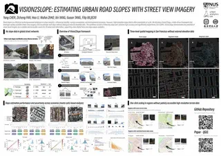
A project to build a Vision2Slope framework. The framework is designed to estimate urban road slopes with street view imagery. The framework is based on computer vision techniques and is designed to be scalable and cost-effective. Code is available at GitHub.

Last updated on Apr 1, 2026
Road Slope Street View Imagery
Yang Chen
Authors
Yang Chen
Ph.D Student

Deep-Time Digital Earth Geomorphology Project May 1, 2022 →

© 2026 Yang Chen. All rights reserved.

Made with Hugo Blox — Open Source. Create yours →