Mapping Global Basic Landforms Using 30-meter DEMs
 Overview of the global basic landforms
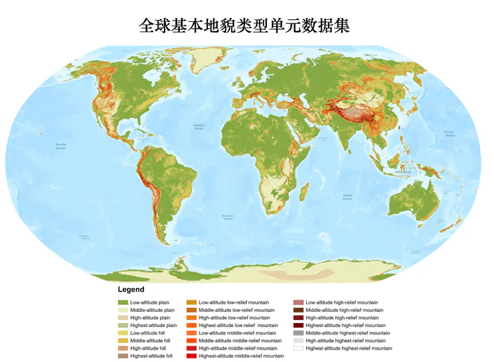
Abstract
The basic landforms are the fundamental units of the Earth’s surface, and their mapping is essential for understanding the Earth’s surface processes and landform evolution. However, the global mapping of basic landforms is still a challenge due to the lack of high-resolution DEMs. In this study, we proposed a new method to map global basic landforms using 30-meter DEMs. The method consists of three steps, (1) extracting the basic landforms from the DEMs, (2) classifying the basic landforms into different types, and (3) mapping the global basic landforms. The results show that the proposed method can effectively map the global basic landforms with high accuracy. The mapped basic landforms can be used for various applications, such as landform classification, landform evolution, and landform change detection.
Type
Publication
In 2023 AGU Fall Meeting
Click the Cite button above to demo the feature to enable visitors to import publication metadata into their reference management software.