
Vision2Slope: estimating urban road slopes with street view imagery
Road slope is a critical yet underrepresented variable in urban analysis. This study presents Vision2Slope, a scalable framework that uses panoramic street view imagery and …
Road slope is a critical yet underrepresented variable in urban analysis. This study presents Vision2Slope, a scalable framework that uses panoramic street view imagery and …
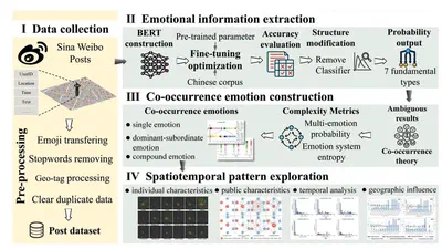
This study proposes a framework that integrates deep learning with co-occurrence theory to classify public emotions from social media data into single, dominant-subordinate, and …
Lunar craters are important geomorphological features, that provide valuable insights into lunar morphology, geology, and impact processes. However, the current understanding of …

This study introduces a 3D framework for assessing 15-minute accessibility in Nanjing, China. Using natural language processing and rule-based methods, we construct a 3D functional …
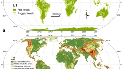
Surveys of global relief classes are important for understanding the morphology and land processes of Earth's surface. This study proposes a novel framework integrating the …

Anthropogenic forces have become a significant factor in the development of geomorphology, influencing landform morphology and usage in diverse ways across natural and societal …
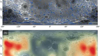
Lunar craters are important geomorphological features, that provide valuable insights into lunar morphology, geology, and impact processes. However, the current understanding of …
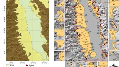
We proposed a novel method for delineating individual alluvial fans based on free digital elevation models. This method incorporated multi-directional hillshades to accurately …
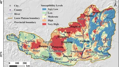
Spoon gullies, characterized by fat heads and thin tails, are a typical type of discontinuous hillslope gully found extensively on the Loess Plateau of China. This study explores …