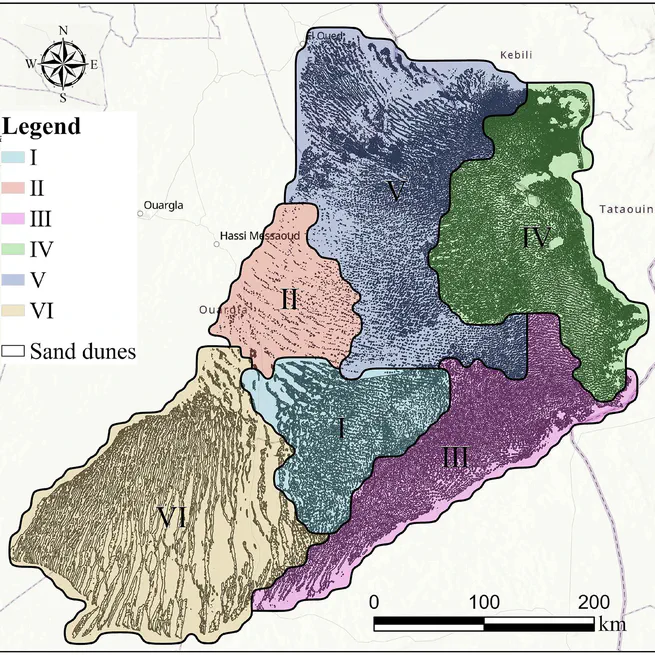
DEM-based sand dune analysis: Identification and morphological regionalization in the Grand Erg Oriental
Sand dunes are predominantly distributed in arid regions. Automatic mapping and regionalization of sand dunes in large-scale areas are crucial to understanding the evolution trends of aeolian sand environments. Different from existing studies primarily focused on mapping the extent of desert areas, this study proposes a framework for automatic identification and comprehensive regionalization based on dunes morphology.
Nov 28, 2024
Refining urban morphology: An explainable machine learning method for estimating footprint-level building height
This study bridged this gap by using random forest models to integrate the elevation, geometry and shape attributes of individual buildings, further refining those with spatial aggregation.
Oct 1, 2024
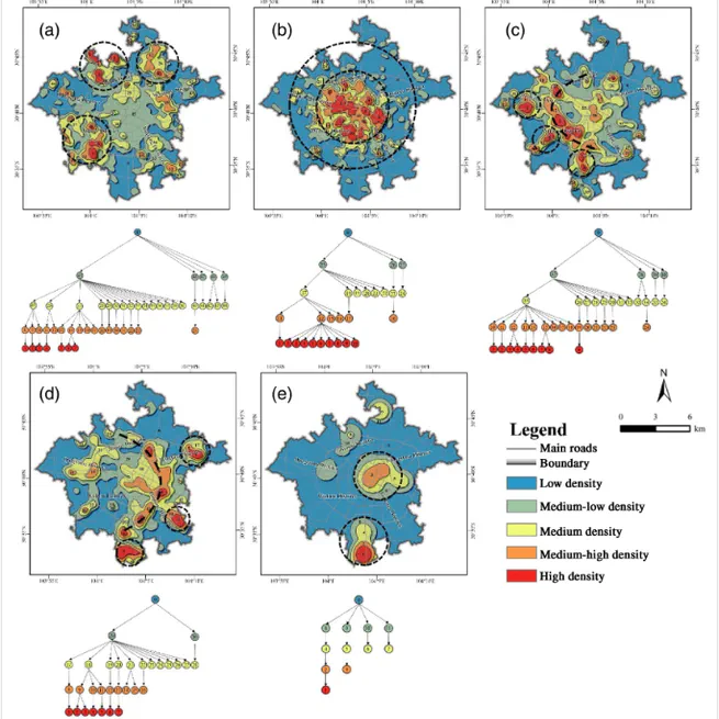
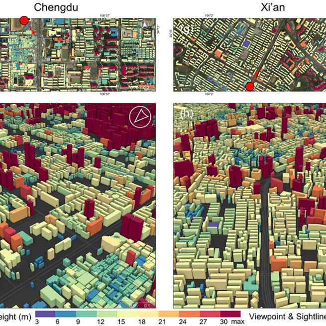
A new hierarchical analysis framework of building heights: Towards a more intuitive understanding of 3D urban structure
This article proposes a new framework to uncover the 3D urban structure. Firstly, kernel density is employed to reveal the hierarchical spatial structure of buildings and the contour tree method is improved to quantitatively measure the spatial diversity and complexity. Then, the 3D urban structure is abstracted by spatial interpolation after feature filtration. Finally, this framework is applied to the central area of Chengdu City.
Dec 28, 2023
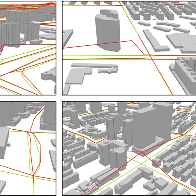
An Automatic Approach to Extracting Large-Scale Three-Dimensional Road Networks Using Open-Source Data
We proposed a novel approach to extract large-scale 3D road networks, integrating terrain correction and road engineering rule constraint, by using the Advanced Land Observing Satellite World 3D-30 m DSM, OpenStreetMap and FABDEM.
Nov 14, 2022