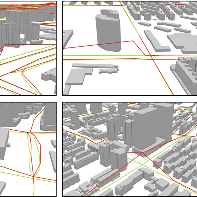
An Automatic Approach to Extracting Large-Scale Three-Dimensional Road Networks Using Open-Source Data
We proposed a novel approach to extract large-scale 3D road networks, integrating terrain correction and road engineering rule constraint, by using the Advanced Land Observing Satellite World 3D-30 m DSM, OpenStreetMap and FABDEM.
Nov 14, 2022