Street View Imagery

A comprehensive vision-based framework for understanding nation-wide urban socio-demographics featured image

A comprehensive vision-based framework for understanding nation-wide urban socio-demographics

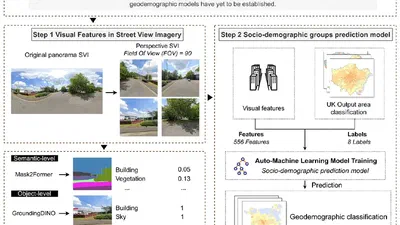
This study introduces street view imagery as a new data source for geodemographic classification. Using 556 image-derived variables across semantic, object, scene, pixel, and …

Kun Zhou
•
Vision2Slope: estimating urban road slopes with street view imagery featured image

Vision2Slope: estimating urban road slopes with street view imagery

Road slope is a critical yet underrepresented variable in urban analysis. This study presents Vision2Slope, a scalable framework that uses panoramic street view imagery and …

avatar
Yang Chen
•
Vision2Slope: estimating urban road slopes with street view imagery featured image

Vision2Slope: estimating urban road slopes with street view imagery

Vision2Slope is an open framework that estimates urban road slopes from panoramic street view imagery using computer vision. It projects panoramas into road-aligned views, corrects …